Sri Lankan piirikunnat 25 hallinnollista piiriä ja maakuntajako
Sri Lankan piirikunnat 25 hallinnollista piiriä ja maakuntajako 9 maakuntaa, piirisihteerien nimitykset ja hallinnollinen rakenne selkeä yleiskuvaus
Sri Lankassa piirikunnat (sinhala: දිස්ත්රික්ක, tamil: மாவட்டம்) ovat toisen tason hallinnollisia alueita. Ensimmäinen taso ovat maakunnat. Kussakin maakunnassa on useita piirikuntia. Maassa on 25 piirikuntaa. Ne on järjestetty 9 maakuntaan. Kutakin piiriä hallinnoi piirisihteeri. Sihteerit nimittää keskushallitus.
Piirikunnat toimivat keskeisinä hallinto-, tilasto- ja vaalialueina. Piirit vaihtelevat kooltaan ja väestömäärältään: jotkin, kuten Colombo, ovat tiheästi asuttuja ja taloudellisesti keskeisiä, kun taas toiset Pohjois- ja Itä-Sri Lankassa ovat harvaan asuttuja. Piirikunnat jakaantuvat edelleen alatasoihin: divisiooniksi kutsuttuihin hallinnollisiin yksiköihin (Divisional Secretariats, aiemmin Assistant Government Agent -alueet) ja näiden alla ovat pienimmät paikallistasot, Grama Niladhari -yksiköt.
Kuvagalleria
8 Kuvat

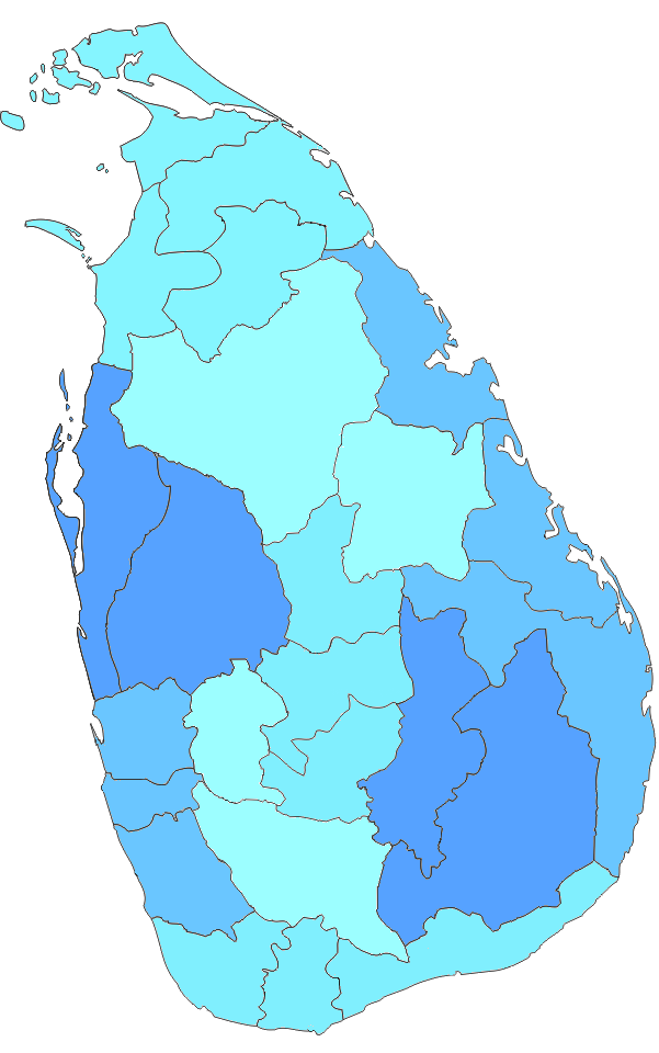


Piirikunnat maakunnittain
- Länsi- (Western) maakunta
- Colombo
- Gampaha
- Kalutara
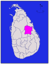
- Keski- (Central) maakunta
- Kandy
- Matale
- Nuwara Eliya
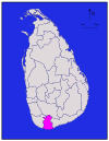
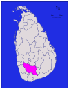
- Etelä- (Southern) maakunta
- Galle
- Matara
- Hambantota
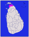
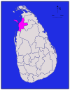
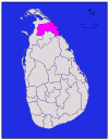
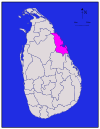
- Pohjoinen (Northern) maakunta
- Jaffna
- Kilinochchi
- Mannar
- Mullaitivu
- Vavuniya
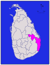
- Itä- (Eastern) maakunta
- Trincomalee
- Batticaloa
- Ampara
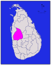
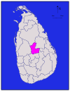
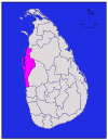
- Länsi–Pohjoinen (North Western) maakunta
- Kurunegala
- Puttalam
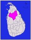
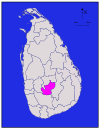
- Pohjois–Keski (North Central) maakunta
- Anuradhapura
- Polonnaruwa
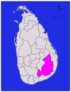
- Uva
- Badulla
- Moneragala
- Sabaragamuwa
- Ratnapura
- Kegalle
Paikallishallinto: Piirikunnan alueella toimii useita paikallisviranomaisia ja -neuvostoja. Kokonaisuudessaan paikallishallinto kattaa kaupungit (municipal councils), kauppalautakunnat (urban councils) ja Pradeshiya Sabha -nimiset maaseutuneuvostot, jotka huolehtivat paikallisista palveluista, infrastruktuurista ja kehityshankkeista. Piirisihteerin lisäksi keskeisiä toimijoita ovat divisioonien johtajat ja paikallisten neuvostojen valitut edustajat.
Kielet ja nimistöt: Piirikuntien nimet esiintyvät yleisesti singaleesin ja tamilin kielillä sekä englanniksi. Virallinen hallinto ja asiakirjat käyttävät usein useampaa kieltä alueen väestörakenteesta riippuen.
Yhteenvetona: Sri Lankassa on 25 piirikuntaa, jotka on järjestetty 9 maakuntaan. Ne muodostavat tärkeän rakenteen maan hallinnolle, paikallishallinnolle, tilastoille ja vaalijärjestelmälle.
Piirit
Kaikki väestömäärät ovat Sri Lankan viimeisimmästä väestönlaskennasta vuodelta 2012. Väestötiheys on laskettu maa-alueen eikä kokonaispinta-alan perusteella (kokonaispinta-ala olisi sisältänyt myös jokien ja järvien pinta-alan).
| Piiri | Alueen kartta | Maakunta | Piirin |
|
|
| Väestö |
|
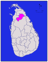
| Ampara |
| Ampara | 4,222 (1,630) | 193 (75) | 4,415 (1,705) | 648,057 | 153 (400) | |
| Anuradhapura |
| Pohjoinen keskus | Anuradhapura | 6,664 (2,573) | 515 (199) | 7,179 (2,772) | 856,232 | 128 (330) |
| Badulla |
| Uva | Badulla | 2,827 (1,092) | 34 (13) | 2,861 (1,105) | 811,758 | 287 (740) |
|
| Batticaloa | 2,610 (1,010) | 244 (94) | 2,854 (1,102) | 525,142 | 201 (520) | ||
|
| Länsi | Colombo | 676 (261) | 23 (8.9) | 699 (270) | 2,309,809 | 3,417 (8,850) | |
| Galle |
| Eteläinen | Galle | 1,617 (624) | 35 (14) | 1,652 (638) | 1,058,771 | 655 (1,700) |
| Gampaha |
| Länsi | Gampaha | 1,341 (518) | 46 (18) | 1,387 (536) | 2,294,641 | 1,711 (4,430) |
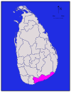
| Hambantota |
| Eteläinen | Hambantota | 2,496 (964) | 113 (44) | 2,609 (1,007) | 596,617 | 239 (620) |
|
| Pohjoinen | 929 (359) | 96 (37) | 1,025 (396) | 583,378 | 628 (1,630) | ||
| Kalutara |
| Länsi | Kalutara | 1,576 (608) | 22 (8.5) | 1,598 (617) | 1,217,260 | 772 (2,000) |
| Kandy |
| Kandy | 1,917 (740) | 23 (8.9) | 1,940 (750) | 1,369,899 | 715 (1,850) | |
| Kegalle |
| Sabaragamuwa | Kegalle | 1,685 (651) | 8 (3.1) | 1,693 (654) | 836,603 | 497 (1,290) |
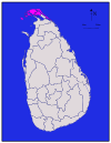
|
| Pohjoinen | Kilinochchi | 1,205 (465) | 74 (29) | 1,279 (494) | 112,875 | 94 (240) | |
| Kurunegala |
| North Western | Kurunegala | 4,624 (1,785) | 192 (74) | 4,816 (1,859) | 1,610,299 | 348 (900) |
|
| Pohjoinen | Mannar | 1,880 (730) | 116 (45) | 1,996 (771) | 99,051 | 53 (140) | |
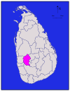
| Matale |
| Matale | 1,952 (754) | 41 (16) | 1,993 (770) | 482,229 | 247 (640) | |
| Matara |
| Eteläinen | Matara | 1,270 (490) | 13 (5.0) | 1,283 (495) | 809,344 | 637 (1,650) |
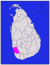
| Moneragala |
| Uva | Moneragala | 5,508 (2,127) | 131 (51) | 5,639 (2,177) | 448,142 | 81 (210) |
|
| Pohjoinen | Mullaitivu | 2,415 (932) | 202 (78) | 2,617 (1,010) | 91,947 | 38 (98) | |
| Nuwara Eliya |
| Nuwara Eliya | 1,706 (659) | 35 (14) | 1,741 (672) | 706,588 | 414 (1,070) | |
| Polonnaruwa |
| Pohjoinen keskus | Polonnaruwa | 3,077 (1,188) | 216 (83) | 3,293 (1,271) | 403,335 | 131 (340) |
| Puttalam |
| North Western | Puttalam | 2,882 (1,113) | 190 (73) | 3,072 (1,186) | 759,776 | 264 (680) |
| Ratnapura |
| Sabaragamuwa | Ratnapura | 3,236 (1,249) | 39 (15) | 3,275 (1,264) | 1,082,277 | 334 (870) |
|
| Trincomalee | 2,529 (976) | 198 (76) | 2,727 (1,053) | 378,182 | 150 (390) | ||
|
| Pohjoinen | Vavuniya | 1,861 (719) | 106 (41) | 1,967 (759) | 171,511 | 92 (240) | |
| Yhteensä | 62,705 (24,211) | 2,905 (1,122) | 65,610 (25,330) | 20,263,723 | 323 (840) |


Kysymyksiä ja vastauksia
Q: Mitä piirit ovat Sri Lankassa?
V: Sri Lankassa piirit ovat toisen tason hallinnollisia yksiköitä.
K: Mikä on Sri Lankan ensimmäisen tason hallintoalueet?
V: Sri Lankan ensimmäisen tason hallintoalueet ovat maakunnat.
K: Kuinka monta piirikuntaa Sri Lankassa on?
V: Sri Lankassa on 25 piirikuntaa.
K: Kuinka monta maakuntaa Sri Lankassa on?
V: Sri Lankassa on 9 maakuntaa.
K: Kuka hallinnoi kutakin Sri Lankan piirikuntaa?
V: Sri Lankan kutakin piiriä hallinnoi piirisihteeri.
K: Kuka nimittää Sri Lankan piirisihteerit?
V: Keskushallitus nimittää Sri Lankan piirisihteerit.
K: Mitkä ovat Sri Lankan hallintoalueiden nimet sinhalaksi ja tamiliksi?
V: Sri Lankan hallintoalueet tunnetaan nimellä "දිස්ත්රික්ක" singalaksi ja "மாவட்டம்" tamiliksi.
Aiheeseen liittyvät artikkelit
Tekijä
AlegsaOnline.com Sri Lankan piirikunnat 25 hallinnollista piiriä ja maakuntajako Leandro Alegsa
URL: https://fi.alegsaonline.com/art/27771
Lähteet
- commons.wikimedia.org : Districts of Sri Lanka
- priu.gov.lk : "At a Glance"
- ds.gov.lk : "Vision & Mission" · web.archive.org
- archives.dailynews.lk : "Kilinochchi a brief look"